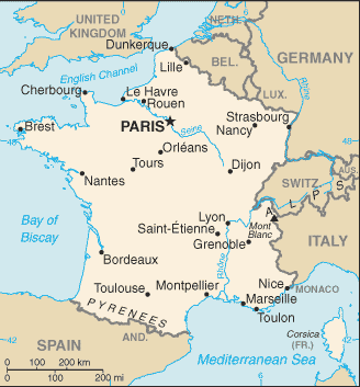
A map of France.
France is a country in Western Europe that is bordered by Spain, Belguim, Italy, Swizterland, Luxembourg, and Germany. During World War II, France declared war on Germany on September 3, 1939. On May 10, 1940, Germany invaded France, Belguim and Holland and by the end of June, Northern and Western France was under German occupation, while the remainder of the country was administered as a free zone by the Vichy regime. The country continued to be occupied by German troops until complete liberation in 1944, following the Allied landings in Normandy.
History
Pre-War Years

France, following the great casualties of the Great War in 1914-1918, had suffered a significant decline in birth rates and as such by the time of the Second World War, its armies were severely undermanned. Furthermore, the economy of France had since not yet recovered and its industries were half their former size.
Riots and attempted political takeovers all worsened the state of the nation. However, collapse was never seen to be a possibility and overall, the condition of France was better than that of other nations which had suffered a larger toll from the war.
Battle of France and Occupation
Vichy France

Diagram showing German occupied areas (in yellow) and Vichy held areas (in pink), together with locations of internment camps.[1]